

|
Site Categories |
|
Featured Items |

Poodle, Spaghetti Trim, Ucagco


|
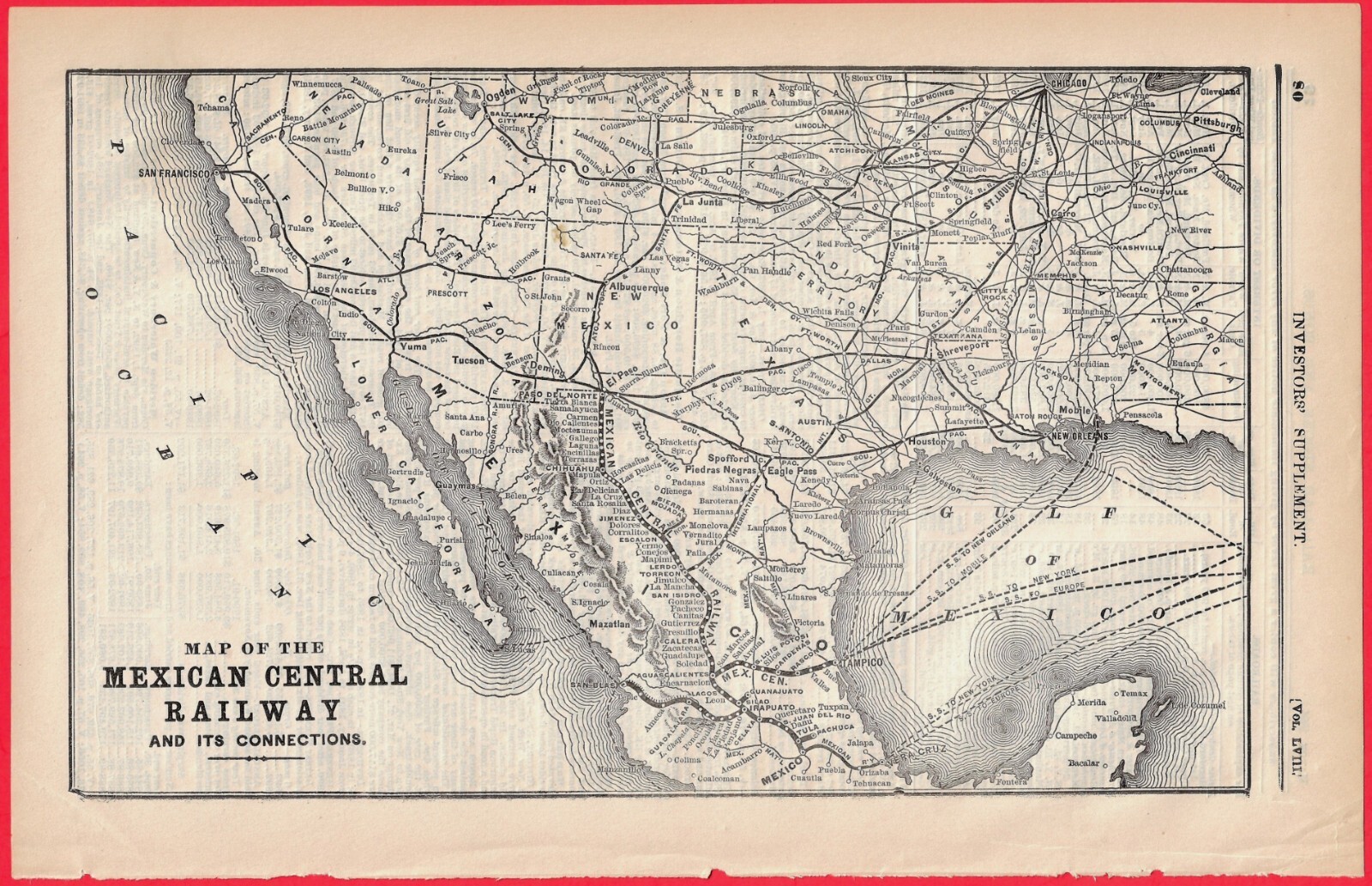
1894 MAP OF THE MEXICAN CENTRAL RAILWAY AND ITS CONNECTIONS For Sale

When you click on links to various merchants on this site and make a purchase, this can result in this site earning a commission. Affiliate programs and affiliations include, but are not limited to, the eBay Partner Network.

1894 MAP OF THE MEXICAN CENTRAL RAILWAY AND ITS CONNECTIONS:
$24.49
Scarce Railroad map from the March, 1894 issue of "Investor's Supplement" to "The Commercial & Financial Times" journal (dated at top of page; reverse side). "Map of the Mexican Central Railway and its Connections." Measures approx. 8 x 12-1/2 inches. This 132-year old map is in very good condition. (Details the primary rail corridor linking Mexico City to the U.S. border at El Paso (Paso del Norte), alongside secondary feeder lines, elevation profiles, and international junctions during the Porfirio Díaz era). 655 Our 27th year on
|
|
Related Items:
1894 Theodore Wagner San Francisco Alameda Contra Costa Antique Cadastral Map $695.00
1894 Manhattan NY map Lower East Side Two Bridges Chinatown NYC $95.00
Vintage 1894 OREGON Map 14"x11" Old Antique Original BEND PORTLAND SALEM EUGENE $30.47
|
|
|
Shopping Cart  |

|
Recently Viewed |
|
Latest Items |
|
Facebook |
Secure Websites

|
