When you click on links to various merchants on this site and make a purchase, this can result in this site earning a commission. Affiliate programs and affiliations include, but are not limited to, the eBay Partner Network.
Item Overview
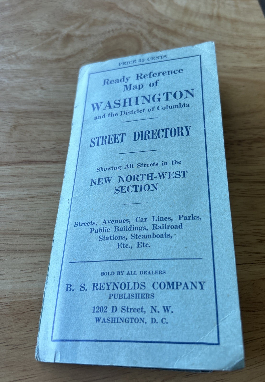
Up for sale or buy-it-now is an authentic, double-sided 1924 vintage edition of The "Standard Guide" Ready Reference Map of Washington.
Originally copyrighted in 1901 by the Foster & Reynolds Co., this specific piece features the detailed 1924 cartography revision. Published jointly by The Foster & Reynolds Co. (New York) and B.S. Reynolds Co. (Washington, D.C.), the map is physically attached directly inside its original blue-green paper street directory cover, unfolding cleanly right from the protective wrapper.
This is a phenomenal piece of early 20th-century travel ephemera, perfectly capturing a rapidly growing post-WWI nation's capital.
Key Historical & Cartographic
Features
Double-Sided Detail: Side one shows a highly detailed, multi-colored street map of Washington D.C. divided into its NW, SW, NE, and SE quadrants.
Side two features a comprehensive overview map of the entire District of Columbia outlining existing highways.
1920s Transportation History:
Features incredible markers of the era, including the "Automobile Tourists' Camp" in Potomac Park, old steam railroad tracks, and local ferry routes ("Boats for Mt. Vernon, Norfolk, Baltimore, Alexandria").
Local Landmarks: Prominently details historical spots like the War College (Southwest tip), the United States Navy Yard, Georgetown College, and American Methodist University (now American University).The "New North-West"
Focus: The cover text specifically highlights the addition of all streets in the newly expanded Upper Northwest D.C. section.
Condition Report :
The Map (Excellent Shape): The interior fold-out map itself is in wonderful vintage condition. The colors are bright, the paper remains crisp, and there is minimal to no fading, staining, or internal text separation along the fold creases. The map remains securely attached to its paper backing.
The Attached Blue-Green Cover (Heavy Wear): The fragile outer paper cover has done its job protecting the map for over a century and shows its age. It has significant edge fraying, corner crushing, minor tearing along the borders, and separation on the bottom edge flap.
😊😊😊Please carefully inspect all included photos to verify the exact condition of the folder margins and map folds before purchasing.