When you click on links to various merchants on this site and make a purchase, this can result in this site earning a commission. Affiliate programs and affiliations include, but are not limited to, the eBay Partner Network.
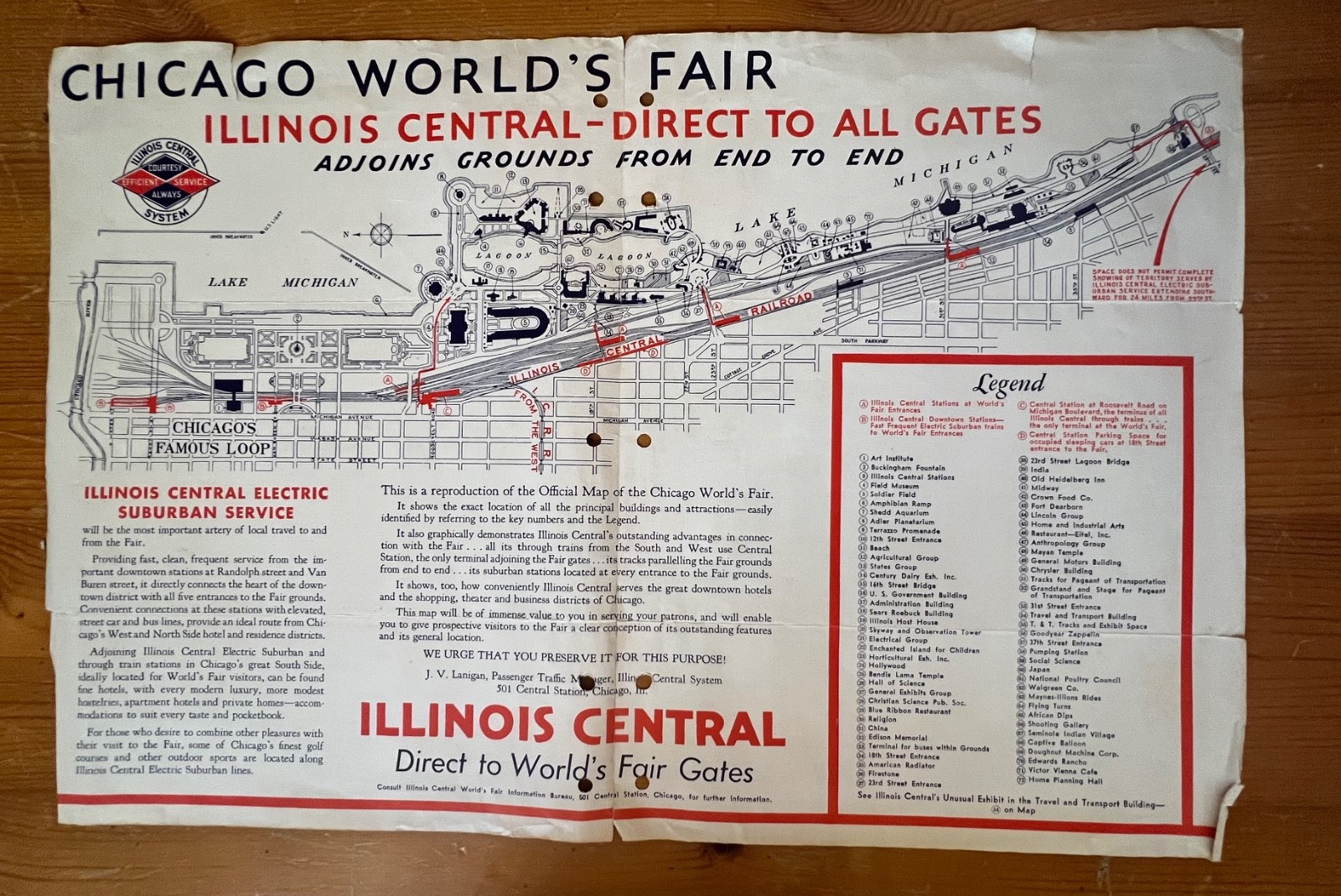
Original 1933 Illinois Central Railroad promotional map for the Chicago World’s Fair (“A Century of Progress”). Measuresapprox19" × 29". Printed in blue, orange, and black, showing the Fairgrounds from end to end, including the Illinois Central Electric line, station locations, major buildings, lagoons, gates, and the Loop at left. Reverse side is blank.This is a large fold-out brochure map issued to promote fast, direct service from downtown and the suburbs to every gate of the Fair. Includes:
Complete IC railroad/fairgrounds route map
Detailed building and attraction map, with numbered legend
Low fares table and suburban timetable
Promotional text encouraging visitors to “leave your car at home”
Small inset map at lower right showing Chicago IC suburban service
Bold heading: “ILLINOIS CENTRAL DIRECT TO ALL GATES– CHICAGO WORLD’S FAIR”
Condition: Folded as issued; fold separations and small tears; edge wear; slight toning; and it was hole punched at the crease.
A classic original map from the Century of Progress World’s Fair, ideal for framing.