When you click on links to various merchants on this site and make a purchase, this can result in this site earning a commission. Affiliate programs and affiliations include, but are not limited to, the eBay Partner Network.
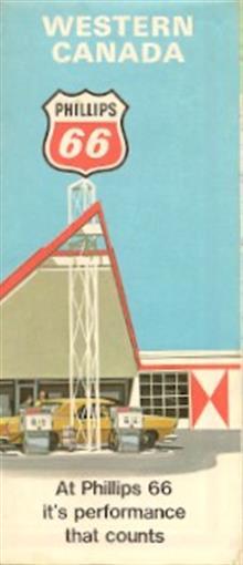
1970 PHILLIPS 66 Road Map WESTERN CANADA Saskatchewan
Handsome fold-out highway map of western Canada, printed more than 40 yearsago.The map opens to 18\" x 27\" and has great detail on old road alignments, with cartography by Rand McNally. The coverage area encompasses Manitoba, Saskatchewan, Alberta, British Columbia, and northwestern Ontario, including Dryden and Kenora.This map was distributed to motorists by the Phillips Petroleum Company of Bartlesville, Oklahoma in 1970 and is copyrighted ©1970 by Rolph Clark Stone Ltd., Toronto.Condition: This map is in excellent condition, bright and clean, with no marks, rips, or tears. We are pleased to offer it withour unconditional, money-back guarantee.
Powered by SixBit\'s eCommerce Solution