When you click on links to various merchants on this site and make a purchase, this can result in this site earning a commission. Affiliate programs and affiliations include, but are not limited to, the eBay Partner Network.
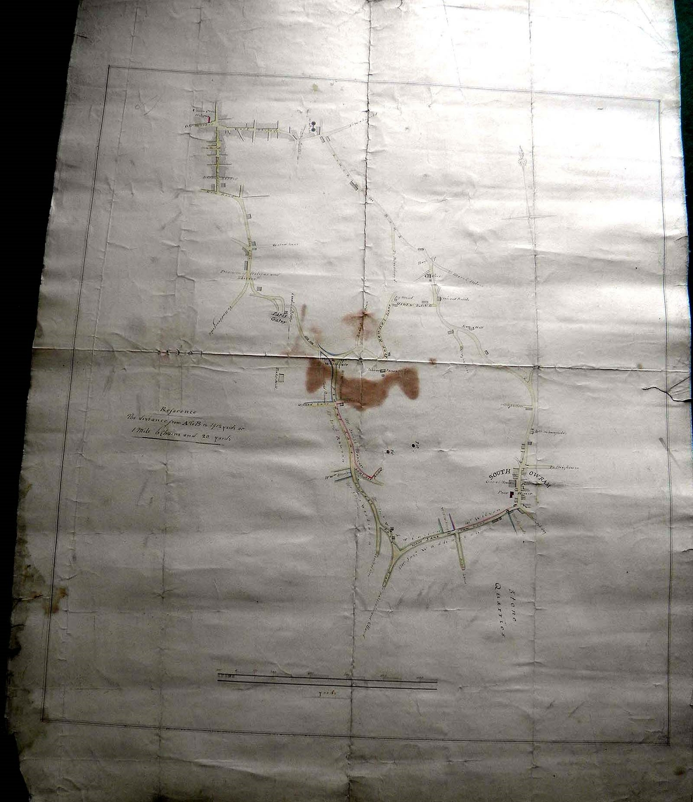
HALIFAX to SOUTH OWRAM Original Circa 1802-1830 Survey plan, Market Place, Gas WThis product data sheet is originally written in English.
YORKSHIRE - HALIFAX to SOUTH OWRAM Original Circa 1802-1830 Important detailed Survey plan, Market Place, Gas Works at Bank Bottom, Paris Gates, Union Cross, Union Street, Horton Street, Wool Shops, Bank Bottom, Bank Top & Cock & Bottle Inn, Higan Lane, Dog Kennel Lane, Whitegate, Siddal Lane, West Lane, Shaw Lane, Poor House, roads to Wakefield, Brighouse, Saltreble & Elland, Huddersfield, Coal Pits, etc. and lands owned by Joseph Waddington. A fascinating original hand drawn survey plan size 22\" x 29\"
:
Powered by SixBit\'s eCommerce SolutionYORKSHIRE - HALIFAX to SOUTH OWRAM Original Circa 1802-1830 Important detailed Survey plan, Market Place, Gas Works at Bank Bottom, Paris Gates, Union Cross, Union Street, Horton Street, Wool Shops, Bank Bottom, Bank Top & Cock & Bottle Inn, Higan Lane, Dog Kennel Lane, Whitegate, Siddal Lane, West Lane, Shaw Lane, Poor House, roads to Wakefield, Brighouse, Saltreble & Elland, Huddersfield, Coal Pits, etc. and lands owned by Joseph Waddington. A fascinating original hand drawn survey plan size 22\" x 29\"