When you click on links to various merchants on this site and make a purchase, this can result in this site earning a commission. Affiliate programs and affiliations include, but are not limited to, the eBay Partner Network.
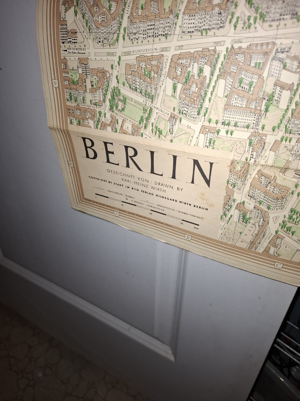
I ran the map through Claude AI since I could not find a map date anywhere...
Origin of the map style: Karl-Heinz Wirth created his first meticulously detailed three-dimensional city map of Berlin's City West in 1957, and bird's-eye-view ("Vogelschau") city maps became a mainstay of his work as a painter and cartographer, with commissions for perspective renderings continuing afterward. PotsdamPotsdam
This specific copy: Since these maps were published and reprinted by Stadt im Bild Verlag Hildegard Wirth over an extended period (the company kept producing folding street atlases/maps of Berlin using Wirth's illustrations for years, likely into the 1960s–70s given West Berlin street names and the Henckels Zwillingswerk store still shown as active), I can't pin an exact year just from this photo. The 1957 date is when the original City-West map was created, but your physical copy could be from that year or a later reprinted map.
- Credit: "Gezeichnet von / Drawn by Karl-Heinz Wirth"
- "Copyright by Stadt im Bild Verlag Hildegard Wirth Berlin"
- Legend: Straßenbahn/Tramway, Endhaltestelle/Tramway Terminus, U-Bahnhof/Subway station
- Legal notice: "Gesetzlich geschützt. Wiedergabe auch auszugsweise verboten" (legally protected, reproduction — even partial — prohibited)
No copyright year, edition number, or print date appears — this publisher's maps typically didn't print a date directly on the sheet itself, since they were reissued/updated over time with the same base design.
Since there's no printed date, the best way to pin down the year is by cross-referencing details within the map itself against known historical changes, for example:
- Presence/absence of certain U-Bahn or S-Bahn stations
- Street name changes (some West Berlin streets were renamed over the decades)
- Businesses shown, like the J.A. Henckels Zwillingswerk store from your first photo — company shop locations sometimes moved
- The tram (Straßenbahn) network — West Berlin phased out most trams by 1967, so if this map still marks tram lines as active, that's a strong clue it predates 1967
Given the presence of an active tram network in the legend and the map's style, this is very likely a late 1950s to mid-1960s edition (consistent with Wirth's original 1957 City-West map and Stadt im Bild Verlag's subsequent reprints before West Berlin's tram system was shut down in 1967).
The map is in great shape! It was previous tacked upon a wall as there are pin holes on the courners. It has one small section tear. But the rest ianin great condition.