When you click on links to various merchants on this site and make a purchase, this can result in this site earning a commission. Affiliate programs and affiliations include, but are not limited to, the eBay Partner Network.
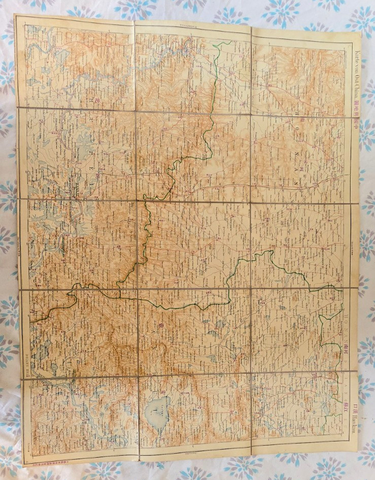
Item Description:This is a rare, original WWII-era Japanese folding map focusing on Central China (specifically the Hubei province and the cities of Hankou and Wuchang). It is an authentic piece of military and cartographic history from the Showa era (1930s–1940s).
The Story & Provenance:This map has a unique and personal history. It was retrieved in the 1990s while my father was stationed in Germany. We were graciously allowed by a local barn owner to explore and collect historical items that had been stored away for decades. This map was among those finds, preserved in a German barn since the war period.
Key Historical Features:
Bilingual Cartography: Features both Japanese Kanji and Romanized place names, used for strategic or international reference.
German Archival Labeling: The reverse side features original German cartographic index tags, indicating this Japanese map was used or archived by German entities during the Hitler-era war period.
Authentic Condition: The map is in excellent vintage condition with vibrant colors. It shows natural age-toning and wear at the fold lines consistent with an original 80-year-old document.
Note to Collectors:I have inherited a large collection of items from this specific era, including:
Historical Postcards and Photographs
Wartime Obituaries and documents
Additional Military Maps and reference Books
If you are a historian, researcher, or serious collector looking for mass information or bulk acquisitions from this period, please reach out to me directly. I am happy to discuss other pieces in the collection or provide more details on specific items.