When you click on links to various merchants on this site and make a purchase, this can result in this site earning a commission. Affiliate programs and affiliations include, but are not limited to, the eBay Partner Network.
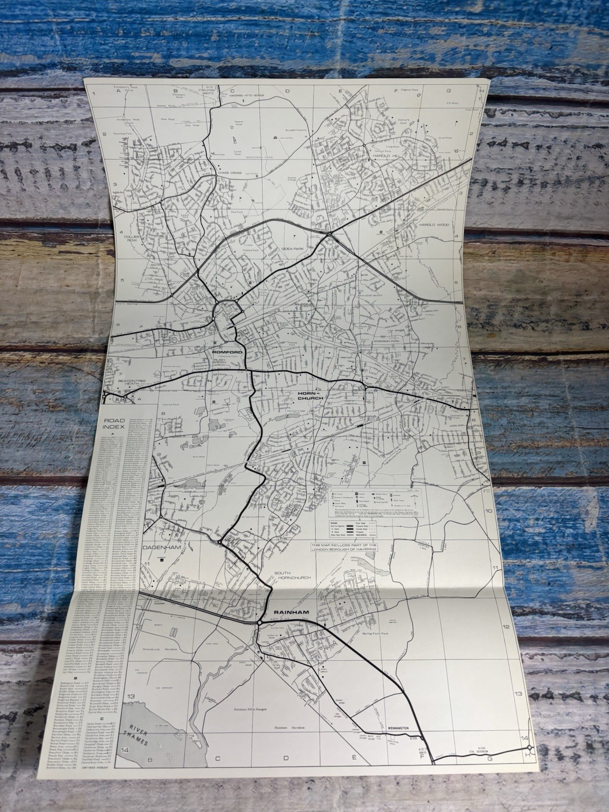
Original vintage Touraco Ltd folding town and road map covering Romford, Hornchurch, Rainham and the surrounding Essex and London Borough of Havering area.
The map is marked B.2/77, dating this edition or revision to 1977.
A detailed period street map showing a large area including Romford, Hornchurch, Rainham, Harold Hill, Harold Wood, Gidea Park, Collier Row, Elm Park, South Hornchurch, Dagenham and surrounding districts.
The map also states that it includes part of the London Borough of Havering.
Features include detailed streets and roads, railway lines, major routes, parks, waterways, local landmarks and an extensive alphabetical road index.
Published by Touraco Ltd., Westcliff-on-Sea, Essex.
Approximate size when opened:
35 cm wide x 62 cm high
13.8 x 24.4 inches
Condition:
Good vintage condition overall with signs of age and previous storage.
The map has original fold lines and creasing from being folded. There may also be light age-related marks, discolouration and minor edge or corner wear.
Please study all photographs carefully as they show the actual item and form an important part of the condition description.
An interesting original piece of 1970s local history, ideal for collectors or anyone with a connection to Romford, Hornchurch, Rainham, Dagenham or the London Borough of Havering.
Ideal for framing, local history research, vintage wall decor or as a nostalgic gift.
Map only. Frame not included.