When you click on links to various merchants on this site and make a purchase, this can result in this site earning a commission. Affiliate programs and affiliations include, but are not limited to, the eBay Partner Network.
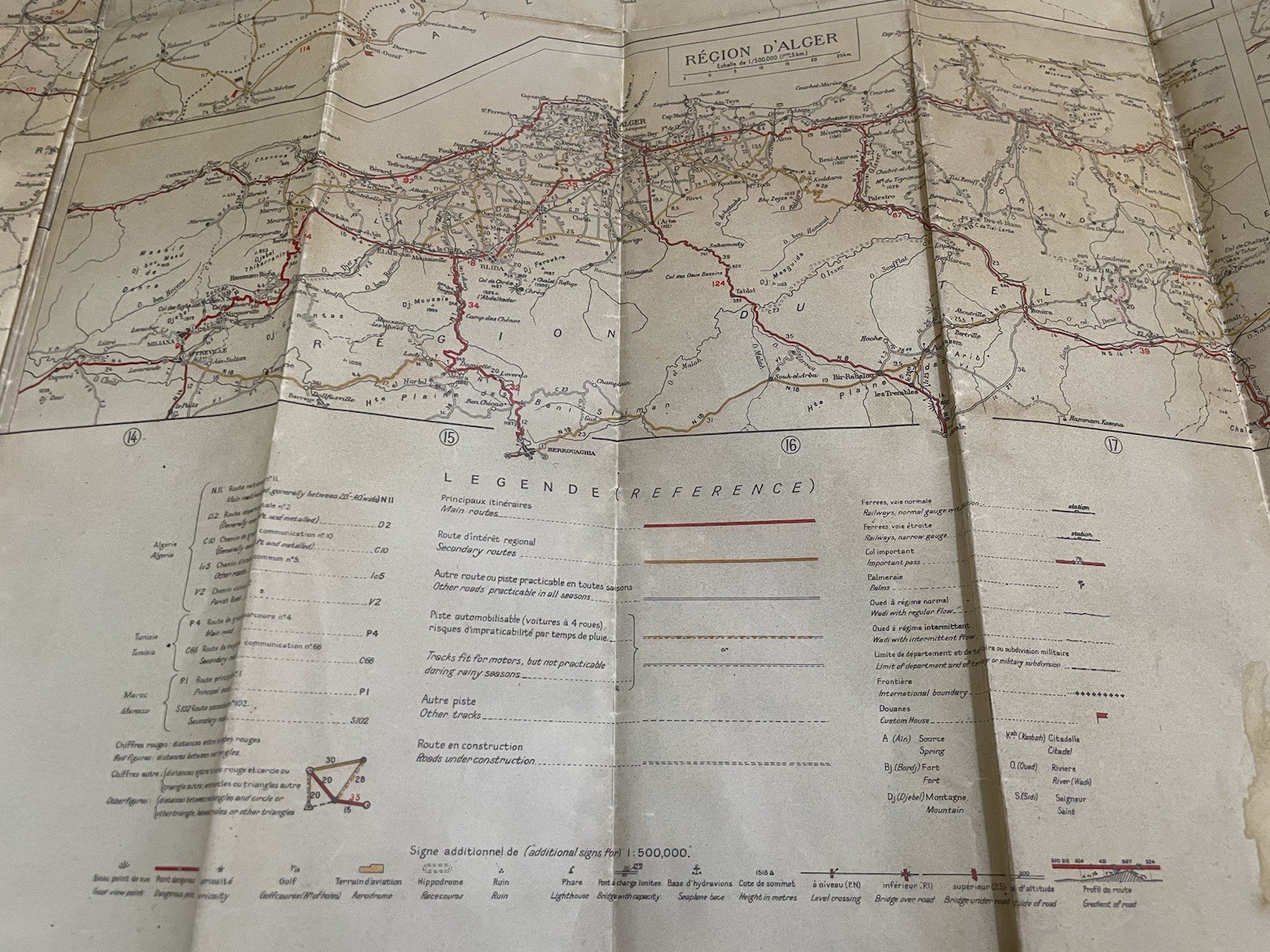
Original WW2 US Army Map - North Africa Roads
This rare piece is a wax paper map produced in 1942 by the US Army map service in Washington, D.C., ahead of Operation Torch. The map depicts the roads of North Africa (within Morocco, Algeria, & Tunisia) and as the map notes, was copied from an earlier French 1939 map. It's a neat piece directly related to the North Africa campaign and these originals are very difficult to find!
Condition: The map itself is intact, with no major tears, and the coloring and print is still strong. However, there is wear from age and use. This includes creases from the folding that are pretty worn, and in several places it has worn through (see pics). There is also a water stain present, a green stain on the back, and a small tear on the right side. Beyond that, there is wear around the edges. I'm happy to provide more pics if helpful.
These original maps are very difficult to find, and make nice items to frame or display, so don't miss out on adding this one to your collection!