When you click on links to various merchants on this site and make a purchase, this can result in this site earning a commission. Affiliate programs and affiliations include, but are not limited to, the eBay Partner Network.
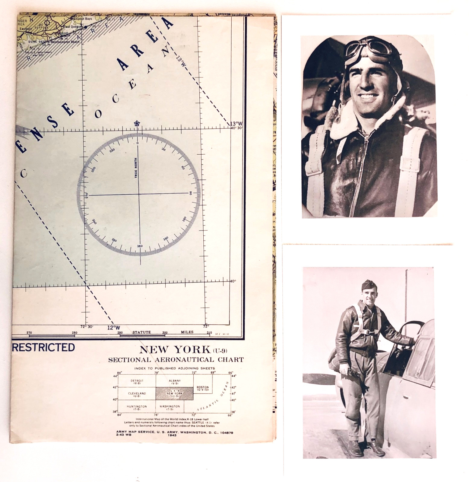
Original World War II New York (U-9) Sectional Aeronautical Chart dated May 13, 1943 and marked RESTRICTED.
This chart was acquired directly from the personal archive of Wilson Saulsbury Garey, a World War II era pilot. It was preserved among family photographs, aviation-related materials, military papers, and other historical documents retained by descendants of the Garey family.
The chart covers the greater New York region and surrounding portions of Pennsylvania, New Jersey, Connecticut, Long Island, and adjacent air routes used during the World War II period.
Compiled and printed by the U.S. Coast and Geodetic Survey, this chart reflects the navigation tools used by military and civilian aviators during the wartime years.
Included with purchase:
• Original 1943 New York (U-9) Sectional Aeronautical Chart
• Signed provenance statement
• Reproduction photograph of Wilson Garey in flight gear
• Reproduction portrait photograph of Wilson Garey
Chart Size (unfolded):
Approximately 44 inches x 24 inches
A desirable piece for collectors of WWII aviation, Army Air Forces memorabilia, military cartography, pilot training materials, aeronautical navigation, and New York aviation history.
ITEM SPECIFICS
Year: 1943
Conflict: World War II (1939-1945)
Original/Reproduction: Original Chart / Reproduction Photos Included
Theme: Aviation
Country/Region: United States
Type: Sectional Aeronautical Chart
Map Title: New York (U-9)
Date: May 13, 1943