

|
Site Categories |
|
Featured Items |

Poodle, Spaghetti Trim, Ucagco


|
WWII D-Day Normandy Map June 6 1944 Allied Invasion German Positions 11x14 print For Sale

When you click on links to various merchants on this site and make a purchase, this can result in this site earning a commission. Affiliate programs and affiliations include, but are not limited to, the eBay Partner Network.

WWII D-Day Normandy Map June 6 1944 Allied Invasion German Positions 11x14 print:
$13.37
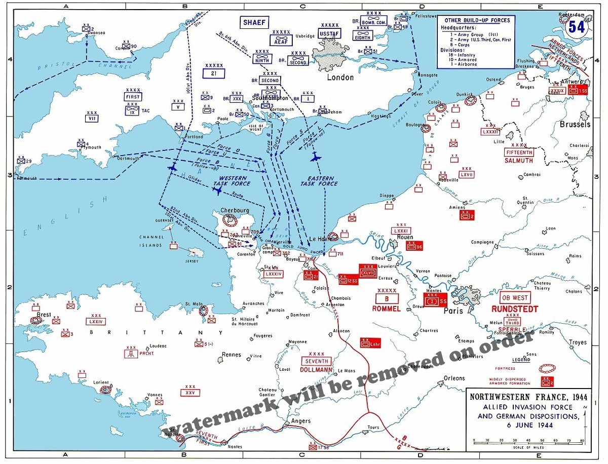
Modern ReproductionWWII Battle MapAllied InvasionPlans & German PositionsNormandy, FranceJune 6, 1944********************* Step back into one of the defining moments of World War II with this detailed historical map depicting the Allied invasion forces and German military dispositions on June 6, 1944 — D-Day. Titled “Northwestern France, 1944 — Allied Invasion Force and German Dispositions, 6 June 1944,” the map illustrates the military situation surrounding the opening of the Normandy invasion. The map shows Allied forces assembling and moving from southern England toward Normandy, including the Western Task Force and Eastern Task Force, along with airborne and naval movement toward the invasion area. German formations and command positions are shown throughout Normandy, Brittany, northern France, Belgium, and the Paris region. Among the historically significant locations and commands shown are: - Normandy and the English Channel
- Cherbourg and the Cotentin Peninsula
- Omaha, Utah, Gold, Juno and Sword invasion Havre
- Paris
- London and southern England
- SHAEF
- Allied air and ground formations
- German Seventh Army
- German Fifteenth Army
- Field Marshal Erwin Rommel
- Field Marshal Gerd von Rundstedt
- German coastal defense and armored formations
Blue markings represent Allied forces and movement, while red markings identify German formations and defensive positions. This reproduction provides an excellent overview of the enormous concentration of troops, aircraft, ships and commands involved in Operation Overlord, the Allied invasion of Normandy that began on June 6, 1944. A fascinating display piece for collectors interested in: World War II • D-Day • Normandy • Operation Overlord • U.S. Army • Military History • European Theater • Historic Maps Search Keywords D-Day map, Normandy invasion map, June 6 1944 map, WWII Normandy map, World War II map, Operation Overlord map, Allied invasion map, German positions Normandy, German dispositions 1944, Normandy landings, Omaha Beach map, Utah Beach map, Gold Beach map, Juno Beach map, Sword Beach map, Eisenhower D-Day, Rommel Normandy, Rundstedt WWII, SHAEF map, Allied Expeditionary Force, military history map, European Theater WWII, D Day memorabilia, WWII wall decor, historical military map, Normandy France 1944, World War 2 reproduction class="MsoNormal" Details - Size: 11x14inch modern reproduction print.
- Paper: Acid-free, professional-quality 80 lb Matte exhibition Art paper.
- Printing: Professionally printed from a high-resolution digital image for detail, clarity, and rich tonal reproduction.
- Quality: Produced using archival-quality materials to create a beautiful display print with excellent sharpness and lasting visual appeal.
- Watermark: The "RT&T Reprint" watermark shown in listing images is not present on the print you receive.
- Image: Your print is produced from the exact historic image shown in this listing. Please review all photos carefully before purchasing.
- Perfect For: Home or office décor, libraries, museums, classrooms, history enthusiasts, collectors, and unique gifts.
- Every print is placed in a clear, acid-free protective sleeve for added protection.
- Shipped flat in a sturdy, rigid, waterproof mailer clearly marked "Do Not Bend."
- Orders are carefully packaged and processed within 1–2 business days (Monday–Friday, excluding holidays).
- We proudly ship worldwide. International buyers are responsible for any applicable customs duties, taxes, or import fees required by their country.
- 30-Day Satisfaction Guarantee.
- If you are not completely satisfied with your purchase, simply return it in its original condition for a full refund in accordance with our return policy.
- Buy with confidence—your satisfaction is our highest priority.
- Images are sourced from the Library of Congress, National Archives, NASA, state historical societies, museums, and private collections.
- Every photograph is carefully restored using professional digital techniques. Dust, scratches, tears, fading, discoloration, and exposure issues are corrected while preserving the historical character and authenticity of the original image.
- Many original photographs are over a century old. While every effort is made to produce the highest-quality reproduction possible, minor imperfections may remain and are considered part of the photograph's historical authenticity.
- This listing is for a modern print reproduction of a historic image. No claim is made to ownership of the original work or to any exclusive copyright.
- These reproductions are sold as collectible display prints for personal use only. No reproduction, publishing, or commercial usage rights are granted.
- We respect intellectual property rights and comply with 's Verified Rights Owner (VeRO) program. If you believe any listing infringes your rights, please contact us so we can promptly investigate and resolve the matter.
|
|
Related Items:
WW2 US Army Airborne Cricket Clicker D-Day Normandy Paratrooper Signal Tool WWII $14.23
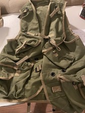
Reproduction US Army D-Day Assault Vest - XL - Made By WW2 Impressions in OD#7 $300.00
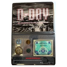
WWII D-Day Normandy Coin & Banknote Set w/ Certificate in Display Binder $37.48
|
|
|
Shopping Cart  |

|
Recently Viewed |
|
Latest Items |
|
Facebook |
Secure Websites

|
