When you click on links to various merchants on this site and make a purchase, this can result in this site earning a commission. Affiliate programs and affiliations include, but are not limited to, the eBay Partner Network.
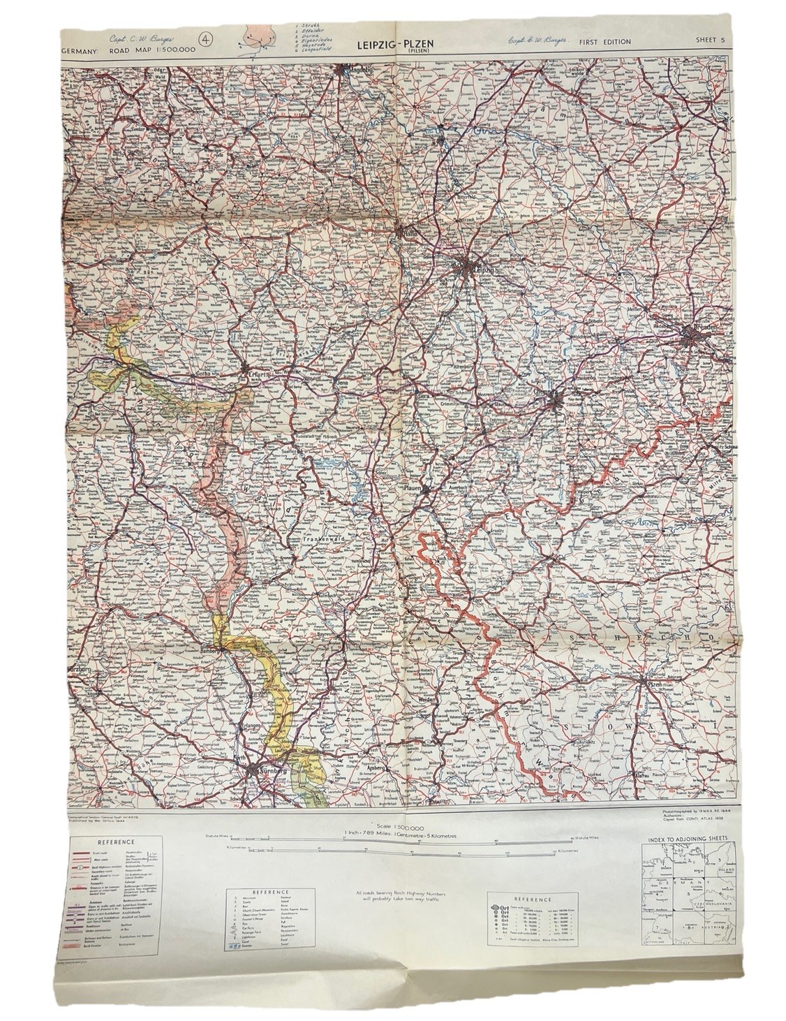
Original WWII-era Germany road map titled “Leipzig–Plzen (Pilsen)” Sheet 5. Published by the War Office in 1944 and copied from the Continental Atlas 1938. Features detailed roads, cities, railways, and regional markings across Germany and parts of Czechoslovakia.
* Title: Leipzig–Plzen (Pilsen)
* Sheet No.: 5
* Scale: 1:500,000
* Published: 1944 War Office
* First Edition
* Large fold-out format
* Includes reference legends and adjoining sheet index
* Condition: Shows fold wear, edge wear, and light creasing from age/use. See photos for details.
Great original WWII military/cartography collectible, display piece, or research item.
34”x23”