When you click on links to various merchants on this site and make a purchase, this can result in this site earning a commission. Affiliate programs and affiliations include, but are not limited to, the eBay Partner Network.
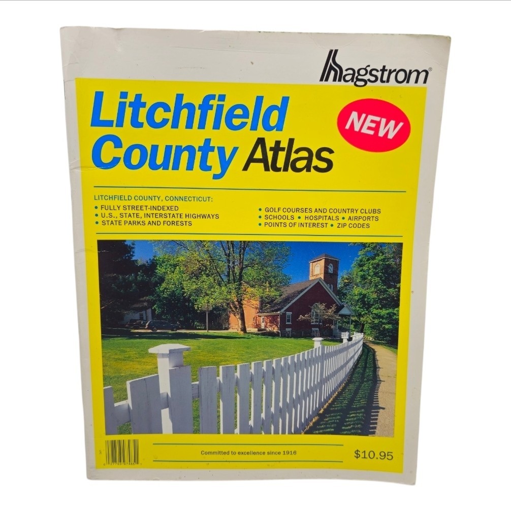
Hagstrom Litchfield County Atlas - Connecticut
Offered here is an unusually difficult-to-find Hagstrom street atlas covering Litchfield County, Connecticut, published by Hagstrom Map Company.
ISBN: 0-88097-485-0
ISBN-13: 9780880974851
Publisher: Hagstrom Map Company
Format: Printed street atlas / paperback
Area: Litchfield County, Connecticut
Era: Early 2000s / bibliographic records identify the title as first published in 2001
Internal map code visible in atlas: S-CC-NP-1599
A Scarce Hagstrom Atlas
This is not one of the commonly encountered Hagstrom New York or New Jersey atlases.
Research into the exact title and ISBN found bibliographic records confirming the Hagstrom Litchfield County Atlas, but surprisingly little secondary-market material for physical examples of this particular county edition. Even photographs and detailed listings for the exact atlas appear unusually difficult to locate.
Open Library\'s Hagstrom Map Company bibliography records the Litchfield County Atlas as first published in 2001 and identifies only two editions.
For collectors of Hagstrom maps, Connecticut ephemera, discontinued road atlases and regional cartography, this is an unusual opportunity to acquire a physical example that seldom appears in ordinary online searches.
What\'s Inside:
This is much more than a simple fold-out road map.
The atlas contains detailed street-level mapping of Litchfield County, along with:
• Municipal and county information
• Extensive street indexes
• Index to places
• ZIP codes and ZIP-code boundaries
• Main highways and through roads
• Municipal and county boundaries
• Railroad lines
• Parks
• Golf and country clubs
• Cemeteries
• Airports
• Hospitals
• Points of interest
• Post offices
• Schools
• Campgrounds
• Picnic areas
• Ski areas
• State parks and forests
• Population information
• Local historical/geographical information
The introductory Litchfield County material even includes descriptions of the county\'s recreational areas, historic towns, parks and forests.
Among the places represented are Litchfield, Woodbury, New Milford, Torrington, Kent, Cornwall, Sharon, Salisbury, Washington, Roxbury, Bethlehem, Bridgewater, New Hartford, Harwinton, Morris, Norfolk, Plymouth, Thomaston, Watertown, Warren, Winchester and surrounding communities.
An Interesting Pre-GPS Snapshot
Beyond its practical map content, the atlas preserves a highly detailed snapshot of Litchfield County\'s roads, communities and points of interest from the early 21st century, before smartphone navigation became ubiquitous.
That makes it particularly interesting for local historians, genealogists, researchers, map collectors, former residents and anyone studying how the region has changed.
Dating & Edition Note:
This physical atlas is the 1999 First Large Scale Edition, as identified by information printed in the atlas itself. Some online bibliographic databases associate this ISBN with a 2001 publication date, while other database information for this scarce title is incomplete or inconsistent. This listing describes the actual physical copy shown in the photographs.
Condition:
This example is in very nice pre-owned condition for its age. Interior pages are clean and colorful, printing remains crisp, and the atlas appears structurally sound. Some minor age/storage/handling wear may be present.
Please examine the photographs carefully. They form an important part of the condition description and show the actual atlas being offered.
Due to the scarcity of this particular Hagstrom title, comparable copies are difficult to locate. It will be packed carefully for shipment to protect its condition.