

|
Site Categories |
|
Featured Items |

Poodle, Spaghetti Trim, Ucagco


|
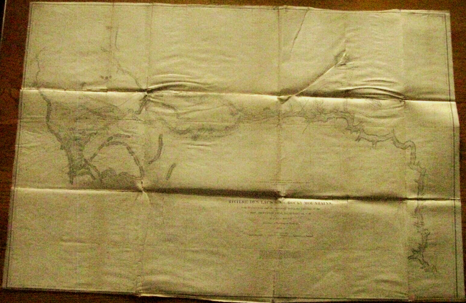
MISSOURI RIVER SURVEY ROCKY MOUNTAINS LINEN MAP 1850S ORIGINAL For Sale

When you click on links to various merchants on this site and make a purchase, this can result in this site earning a commission. Affiliate programs and affiliations include, but are not limited to, the eBay Partner Network.

MISSOURI RIVER SURVEY ROCKY MOUNTAINS LINEN MAP 1850S ORIGINAL:
$195.00
In the early 1850s Congress and the US Government decided to explore the West in an effort to select a route for a proposed Transcontinental Railroad to California and the Pacific Northwest. Much of the West was still unexplored and the US Army assigned skilled officers to lead expedition, exploring the various latitudes for potential routes, also to search for mineral deposits, report of Indian tribes, and collect natural history specimens. This Survey Reports contained detailed descriptions of the West with maps, including some large linen backed foldout maps. An original War Department Linen Backed Survey Map of explorations near the 47th and 49th Parallels " Riviere des Lacs to the Rocky Mountains " explorations directed by Secretary of War Jefferson Davis and Isaac Stephens, Governor of Washington Territory, 1853-54The map shows a scale of Scale of 1:1200000 and includes the Lewis and Clark Pass, Army Exploration Routes of Doty, Lander, Stephens, Donalson, Tinkham, landmarks incl Mairais Pass, Forts Benton, Fort Union, Berthold, Pierre and others, Citadel Rock, Judith Mountains, Camp Armstrong and other named camps, also Great Falls, Milk River, Mouse River etc. The map lower edge bears the engraver imprint of Selmer and Seibert.This 37 x 25 " original report cream color linen backed map is in Good Condition w age stains, edge wear, creases and small holes at a few folds with acid free archival linen repairs on the reverse Overall VG
|
|
Related Items:
Pre-Sale 30lb Elderado Bar Missouri River Montana Sapphire Gravel $160.00
MISSOURI RIVER SURVEY ROCKY MOUNTAINS LINEN MAP 1850S ORIGINAL $195.00
Cape Girardeau MO-Missouri, River Front Flood RPPC Real Photo Postcard (1K) $24.95
|
|
|
Shopping Cart  |

|
Recently Viewed |
|
Latest Items |
|
Facebook |
Secure Websites

|
