When you click on links to various merchants on this site and make a purchase, this can result in this site earning a commission. Affiliate programs and affiliations include, but are not limited to, the eBay Partner Network.
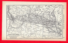
Item Description: Authentic 1926 Antique Railroad Map – Canadian Pacific Railway & Connections (Western Section).Publication Date: November 1926.Publisher: Originally issued for the Investors\' Supplement of the Commercial & Financial Chronicle.Current Physical Dimensions: 7-3/4\" x 12-3/4\" (Slightly trimmed down from its original 8\" x 12-3/4\" format).
This single-page historic document maps out the expansive rail infrastructure of the Canadian Pacific network at the height of the Roaring Twenties.
Strategic Rail Lines Shown: Canadian Pacific Railway (CPR), the Minneapolis, St. Paul & Sault Ste. Marie Ry. (The Soo Line) – Spanning America\'s Upper Midwest (North Dakota, Minnesota, Wisconsin). Duluth, South Shore & Atlantic Railway (DSS&A), Spokane International Ry. – The vital link into the Pacific Northwest.
Condition, Trim, & Framing Notes: Type: This is a flat, single-sheet, stand-alone display page (not a folding map). It is ideal for display. Trim Note: The piece currently measures 7-3/4 x 12-3/4 inches. It was cleanly removed from a compilation and has been slightly trimmed along the side border by 1/4 inch (originally 8\" wide). It remains excellent for standard custom framing or archival matting. Paper Integrity: Having spent decades pressed flat inside a bound reference volume, the paper has been completely protected from damaging UV sun exposure. The black ink remains incredibly crisp, sharp, and highly readable. Seems to have been printed slightly off-center.
776 Our 27th year on